Running | Trailrunning

Nauderer Höhenweg small

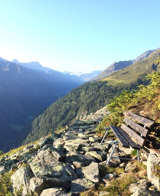
Like the N4 route, it goes uphill from Nauders to the Labaunalm and the somewhat steeper climb to the Labauner Köpfl. Now comes the heart of the loop: On the dreamlike and mostly lonely high trail, it goes for several kilometres in a gentle up and down. After about 12 km, however, you branch off from the high-level trail and walk on a pleasant gradient through the sparse mountain forest back to Nauders.
tour1
1038m
18.1km
Highest point
2220m
Start point
Nauders Parditsch
End point
Nauders Parditsch

Similar Tours

Medium
892m | 16.4km
Running
Gepatsch-Runde
Begin: Parkplatz Fernergries
End: Parkplatz Fernergries
Medium
1042m | 17.7km
Running
Thomas Penz Höhenweg
Begin: Feichten
End: Feichten
Easy
324m | 6.9km
1613m | 29km
Running
Trailrun -
Begin: Prutz
End: Enz
Medium
428m | 8.8km
Running
Trailrun - Klammsteig - Greit
Begin: Infobüro Pfunds
End: Infobüro Pfunds
Medium
694m | 12.9km
Running
Trailrun - Spiss - Alpe Zanders
Begin: Spiss
End: Spiss
Medium
2424m | 30.9km
Running
3-Länder Höhenweg
Begin: Talstation Mutzkopflift
End: Talstaion Haideralm
Easy
190m | 12.8km
Running
Trailrun - Ried - Tösens - Ried
Begin: Infobüro Ried
End: Infobüro Ried